
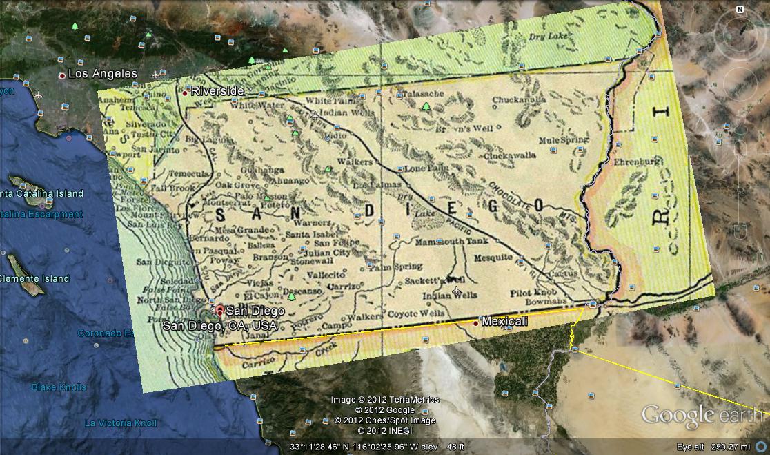
For our practice we were asked to take a historical map and place it over the Google Earth maps. It was pretty easy. After finding a map, which was the hardest part, I simply saved it and opened Google Earth. After that I placed the map down and looked at the border of Mexico to begin aligning my maps. Shortly after adjusting so that the border’s lined up on both maps I had to zoom out. I needed to do this to stretch the map out because San Diego county is actually pretty big. After stretching it out to fit, I lined it up with the ocean and the border of Arizona. San Diego county doesn’t stretch out to Arizona now so I learned that it actually used to which is interesting on its own. The last thing I used to align the maps was the river and that’s how I got the maps to match!
The map you found is of really excellent quality. Great line up!